City Point Facilities
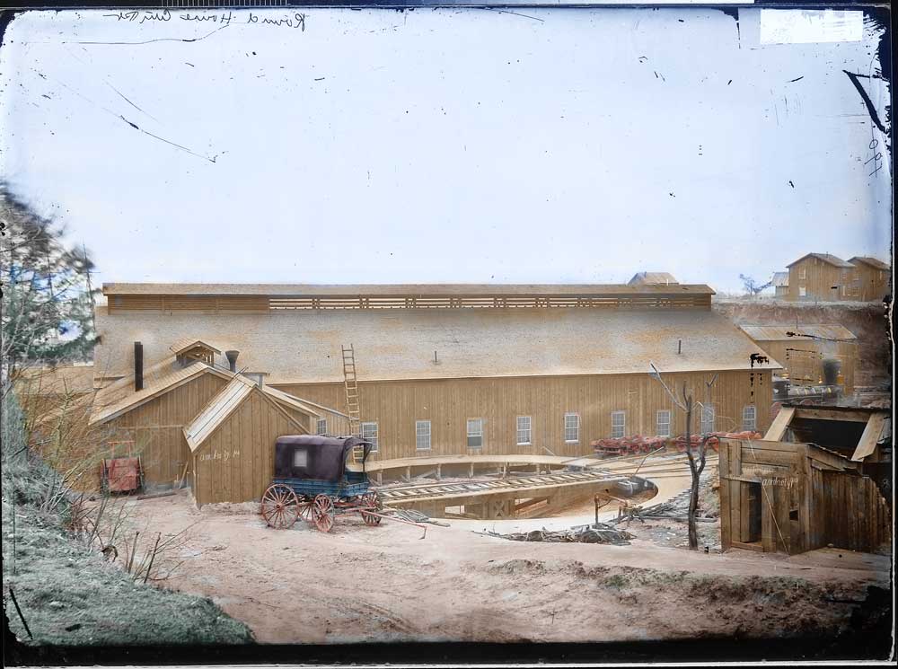

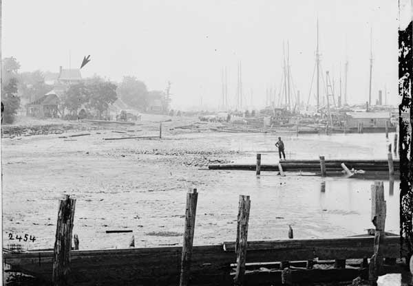
Library of Congress - LC-USZ62-102739
Above and below are two views that show the extent of the change that occurred during development of the City Point facilities. Note the house on the bluff that is about the only thing that tells us that these are almost the same views. These pictures were taken from the area of the railroad wharf, looking west or upstream, This position is towards the left of the Merrick map, looking along the river toward the center of the map.
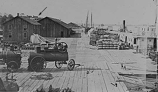
National Archives - 525096
I love the steam engines seen in this photograph. Steam engines were used to pump water from the river to the water towers near the engine house, and also at the main army hospital in order to provide running water for sick and wounded soldiers. I believe that they were also used to saw lumber to size in the lumber yard. Other photographs show steam driven pile drivers that were used in construction of the port.
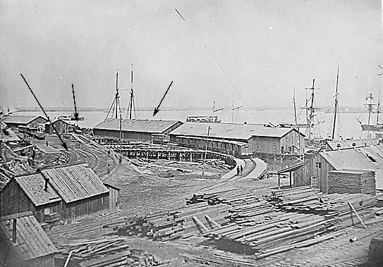
National Archives - 524482
Above is a view that closely corresponds to the Merrick maps. Note the tracks(on left) and warehouse (middle left). There is a end of year (FY1865) report by D.C. McCallum, Superintendent of Military Railroad in Virgina in the Official Records. That report gives an indication when this warehouse was put up.
"Not much of note in railroad affairs
occurred from February 28 to April
3. The construction department was kept busy making additional
improvements wherever needed, and building a wharf at City Point,
in
the gap between the quartermaster's and railroad wharves."
Library of Congress - LC-DIG-ppmsca-08248
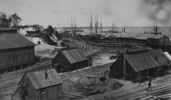
This very similar view of the rail yard and the warehouses shows less trackage and fewer structures than found on the Merrick maps. This particular photograph was taken by A.J. Russel, army photographer. The extra tracks and warehouse pointed out in the previous picture are not present. However the building on the far right, is no longer present in the later view and either burned or was torn down. It would be nice to find a way to date this particular view.
I'm hoping to date my model railroad during the time of a significant troop movement. Right now, I'm trying to determine the extent of construction done before the return of the 6th corps from the Shenandoah Vally at the beginning of December 1864. The engine house and turntable was put in October. Seems like other structures were done right about this time frame. The following statement is taken from McCallum's end of year report.
"From November 10 to December 19 the construction force were busily engaged in constructing hospital buildings, repairing wharves, laying additional side tracks, and building quarters for the Quartermaster's Department and railroad employees. A large clothing warehouse and extensive commissary buildings were then built; also distribution barracks for the accommodation of the troops passing through City Point. The coal wharf at City Point and a large wharf at Bermuda Hundred were also completed."
I don't know of any other major troop
movement,
after the return of the sixth corp and prior to Grant's
breakthrough in
early April. The movement of the 24th
corps to Fortress Monroe (and eventually Fort Fisher) in early
January
1865, was through Bermuda Hundred landing, not City Point.
I used this end on picture of the engine house at City Point to
calculate some major dimensions.
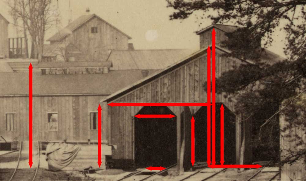
Crop of high resolution image loaded from Library
of Congress (LC-DIG-ppmsca-08267)
This can be done, because we know the track gauge is 4' 8.5" or
4.7'. By measuring the track and doing some simple
calculations, we can get pretty good estimates of the end
dimensions of the engine house. The calculations
should all be considered approximate, but they make a good
starting point for modelling. It seems the the camera was
positioned pretty evenly with the bluff in the background, so we
can also get some estimate of the height of the bluff, though
somewhat less accurately.

| Size of large storehouse complex | 1000 feet long by 50 feet wide |
| Length of wharf | greater than 1/2 mile |