I drive past this spot during my commute to work and there seems to be ton of history and ideas for modeling around this spot on the Concord River, north of Boston. As time allows, I will try to improve and add to the pictures I have presented here.
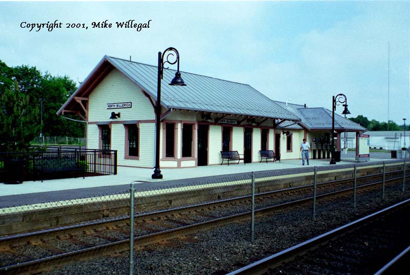
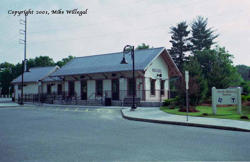
First on the list, is North Billerica Station which has just recently gone through an extensive refurbishing. This station is on the National List of Historic Places.
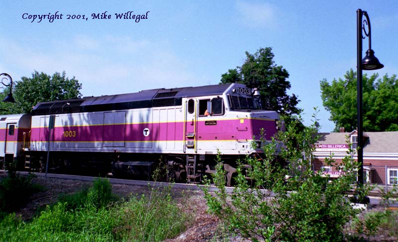
It currently serves commuters using the MTBA Lowell line to reach Boston.
It is just a mile or so north of Guilford Transportation's headquarters
in Billerica. It's not very busy with freight, though. I think most Guilford
freight traffic in the area is headed east and west through Lowell, just to
the north.
Here is a view of the west side of the station. To cross the tracks from
east to west, you pass under a Railroad Bridge (not pictured) just south of
the station. I don't know when it was originally built, but the abutments
are made of stone.
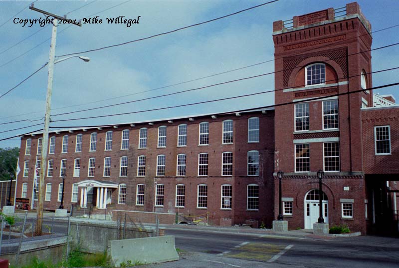
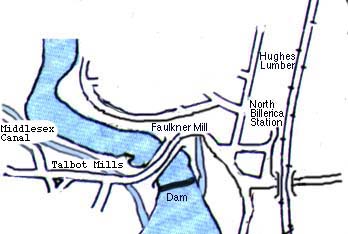
One block to the west there are some old New England style mill buildings
grouped around a dam on the Concord river. The Faulkner Mill building has
also been undergoing some renovations over the last few years. There are
still some canals in existence here, leading under the buildings where I
suppose in the past they drove turbines that ran the mills. At the bottom
of the picture, one canal can just be seen passing under the road towards
the building.
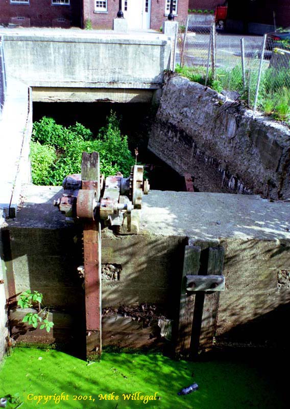
Here is a detail of interior of the ruins of the same canal. Modelers, the beer bottle could be omitted.
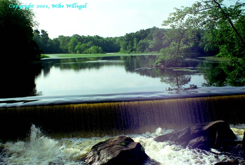
This canal is fed from a pretty pond behind this dam on the Concord River.
During the spring thaw, an incredible amount of water passes through here.
The historic Middlesex Canal
passed across this pond, using a floating tow-path.
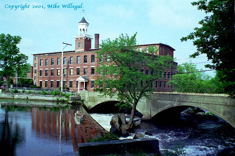
Across the river is Talbot Mills, an elegant old New England style mill
building. Cambridge Tool now occupies at least part of the complex. The
ruins of a Middlesex Canal lock are underneath the parking lot, which bridges
the site of the lock.
Imagine modeling the brief period in the19th century, when the canal and the railroad both operated in this area.
Note: All pictures taken on 6/16/2001. Click on thumbnails to see larger
view (most are around 100k).