Technology and the Civil War

The classic image of the Civil War portrayed by authors like Bruce Catton had men and horses marching on foot for days over dusty or muddy roads. This would be interrupted by an occasional horrible and not quite decisive battle. While this image of war is certainly true, there is another side to what was going on during the Civil War.

Troops were often transferred vast distances by rail or boat. Telegraphs were setup to provide almost instant communication across the same vast distances. Steam powered gunboats patrolled the rivers. Hospitals were supplied with running water. By the end of the war, economic warfare was a key part of the North’s strategy, while the southern forces embraced raiding and guerrilla warfare. Most northern cavalry units were equipped with breechloading rifles, many of them repeaters. Hydrogen balloons were used for observation, though later in the war it was determined that, if given a few days time, building a tall tower could achieve a similar result, with a lot less hassle and risk.

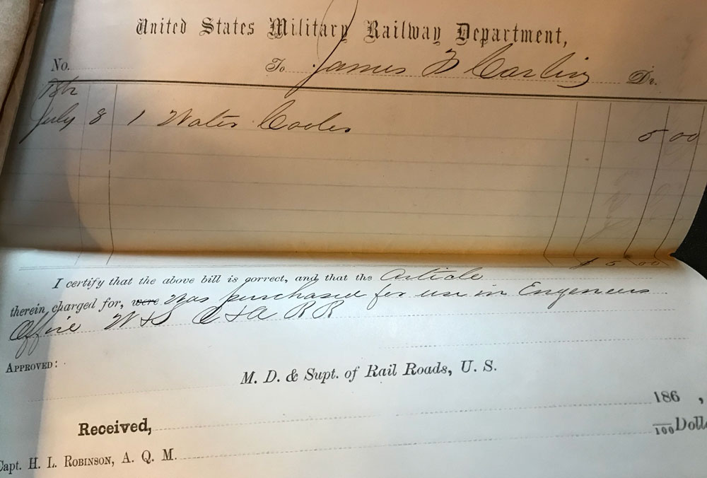
When I stopped at the National Archives late last year, I discovered that the men staffing the US Military Rail Road’s depot in Alexandria Virginia enjoyed some surprising luxuries. I found invoices for gas pipe and gas lanterns. Further research indicates that a gas works was installed in Alexandria in the 1850s. The USMRR railroad must have tapped into it.

Invoice for Water Cooler

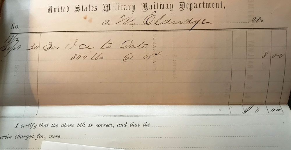
I also found invoices for water pipe, a water cooler and 800 pounds of ice. Finding the invoices for the ice and water cooler was quite a surprise.

Invoice for Ice
Invoice for Ice

Though those times were primitive by today’s standards, it’s clear that when possible, those soldiers would do what they could to make themselves as comfortable as possible.

“Stonewall” Jackson’s Raincoat

“Stonewall” Jackson was shot by his own men while in the front lines doing some scouting while wearing this rain coat.

How come I don’t remember anyone, pointing out that from a short distance or in the haze, smoke and confusion of battle that “Stonewall” Jackson’s Raincoat would look almost identical to a Union Officer’s Frock coat. Seems like a poor choice of clothing for the occasion.

I’m just saying…

Well Known Game Designer, John Hill, has Died

It’s sad to see another icon of the wargaming world, has died. I found out today that well known game designer John Hill has died on January 12th, at age 71.

I was deeply involved in wargaming in the mid to late 70’s and spent many hours playing his most well known game, “Squad Leader”. He also designed a popular Civil War Miniature’s rule’s set called “Johnny Reb”.

More on the Sightseeing Sixth Division in World War I

In a previous post, I noted how my Grandfather was a member of the Sightseeing Sixth Infantry Division in World War 1. I found a history of the Sixth Infantry in World War 1, written at the end of the war. The history can be downloaded from this site

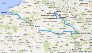
Using this history and Google Maps, I created a rough map of where my Grandfather might have travelled. The routes from place to place are not exact, but the general areas where the Sixth travelled up to the end of the war are taken from the history. Travel from the LeHarve to the training facilities around Chateau Villain would have been by the famous 40 men or 8 horse box cars.

The Sightseeing Sixth Division in France in the Fall of 1918

The Sightseeing Sixth Division in France in the Fall of 1918

The other interesting thing that I learned was the extreme lack of transportation that troubled the Sixth Infantry’s movements. Horses were poor cast offs from the French army. Often the men hauled their equipment themselves, instead of relying upon horses or trucks. Once at the front, most travel was on foot. It is interesting that my Grandfather was a truck driver for a unit that apparently had very few trucks. The only mention of type of truck, was a brief mention of usage of some “liberty trucks”.

Grandfather Willegal’s Experience in World War 1

My Grandfather was a World War 1 veteran. I only talked to him once about his war experiences. He was a truck driver and told me how he used to get those old trucks up to a speed of 60 miles an hour. I also remember him saying that the army in World War 1 was the last good army or something to that effect. I’m not exactly sure why he held that opinion, but he wasn’t bashful about making the claim. My Grandfather also showed me some trench art that he had made out of some cartridge cases. I wish I knew where that trench art was. Hopefully someone in the family got a hold of it, after he passed away.
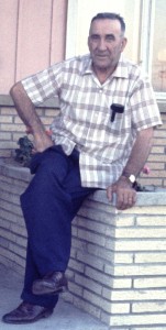
Grandpa Willegal - circa 1960

Grandpa Willegal – circa 1960

I learned a little bit about my grandfather from my dad. He once told me that Grandfather mentioned that when they were being shelled by the German artillery, that they would take cover in the ditches by the side of the road. I was once visiting Circus World Museum with my dad, and he mentioned that the trucks in the circus train display would be similar to those trucks my Grandfather drove in World War 1. I think the Circus World trucks are Mack AC’s, which were indeed, used in World War 1 by the British and Americans. I don’t know for sure that this is the type of truck he drove, but it’s possible. The Mack AC’s have a rated speed of 18 miles per hour. Another army truck of the time, the famous Liberty Truck, was only supposed to reach 15 miles per hour. I wonder what my Grandfather was doing to get up to 60 miles per hour.

My sister did some online searches and found a few records, including this certificate of service which she found at the Wisconsin’s Veteran’s Office.
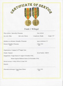
grandpa Willegal's Certificate of Service

grandpa Willegal’s Certificate of Service

It turns out that he was a member of the Sixth Infantry Division. The medal depicted at the top of the certificate is the World War 1 victory medal. He is given credit for participating in Vosges Sector (Aug 31, 1918 – Oct 18, 1918) and the Meuse-Argonne Defensive Sector (November 2-6, 1918). The other interesting thing is how quickly he was moved into the combat zone. He joined the army on May 4th, 1918 and was overseas by July 14, 1918. By August 31st, the 6th Division was on the front lines.

There is some information on the Sixth Infantry Division in World War 1 at this site. The Sixth Infantry Division site focuses on the World War II, but there are a few tidbits about the Division’s activities in World War 1. The interesting thing is that this brief history mentions how the division was involved in marches that were subject to German artillery fire, just like my grandfather told my father.

My research on the Sixth Infantry shows that they did a lot of marching, during which time, they picked up the nickname, “The Sightseeing Sixth”. Like most new American divisions, after training they were moved to the relatively quiet Vosges Sector in order to become adapted to actual combat conditions. Here is website with some information about the Vosges Sector. They were in reserve at the end of the war. Apparently they were about to be committed to the Meuse-Argonne offensive, when, rather unexpectedly, the war ended.

The Meuse-Argonne offensive was a very bloody affair. Who knows, I may not be here, if the war had lasted much longer and the Sixth Infantry ended up being committed to that fight. I plan upon putting together a blog entry comparing the Meuse-Argonne offensive of World War 1, with the biggest American battle of World War II.
Remembering Original D&D, TSR and FITS

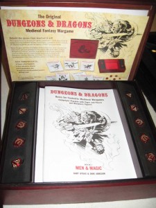
D&D Reprint

D&D Reprint

I recently picked a reprint of the original version of TSR’s Dungeon’s and Dragon’s. It’s a reprint of what many people call the white box version of D&D. Actually the first few printings of D&D came in wood grain cardboard boxes. After a few printings they changed to a white box.

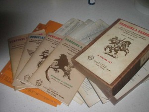
D&D 3rd printing

D&D 3rd printing


This image is a third printing that I sold for $1600 a few years ago. My first copy was a first printing that I bought from Brian Blume. This was right after spending a Sunday afternoon in Gary Gygax’s basement exploring Greyhawk, his fantasy land. At that time, they sold the game by inviting people to play it. I believe that Brian told us at the time that they spent several thousand dollars printing that first 1000 copies. I think I learned later that Brian’s father financed the early TSR projects. I don’t know what happened to that 1st printing copy of D&D. I’m sure it was pretty well worn out, as we played the game quite a bit, back in the day. The 3rd printing copy I sold for so much, was a replacement for a worn out first printing that I picked up directly from Gary Gygax who often manned the TSR booth at GENCON.

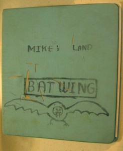
Batwing - D&D circa 1975 & 2014

Batwing – D&D circa 1975 & 2014


My kids and their friends have recently enjoyed a few trips down into my old dungeon, which is called “Batwing”. Amazing that this old game still can capture the imagination of young people. Maybe more amazing that I held onto that binder for all these years.

FITS Box Cover

FITS Box Cover


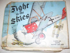
Now if I could only convince them to give “Fight in the Skies” a try. “Fight in the Skies” is a World War 1 air combat game that has an element of role playing. FITS is said to be the one game has been played every single year at GENCON. Back in the day, I know I played FITS more than once at GENCON with Mike Carr, the author of the game.

Speaking of FITS, GENCON, Brian Blume and Mike Carr, I’ll never forget the first GENCON South in Jacksonville, Florida in 1978. At this time I was friends with a number of the TSR staff, but living far away in South Florida. Mike Carr and Brian Blume made the trip to Jacksonville to represent TSR. Some friends and I drove up to Jacksonville from South Florida. We ended up going out to diner with Mike and Brian. At one point, I told them that computer gaming wasn’t likely to take off, as the interactive social element wasn’t as strong in computer games as other forms of gaming. Most computer games in 1978 pitted you against the computer, or required multiple players to take turns at the controls. Boy, was my vision wrong. I hope I didn’t affect their business plans too much with my bad advice.

FITS Rules Book and Pilot Cards

FITS Rules Book and Pilot Cards


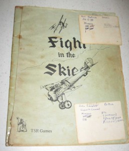
Speaking of FITS. I still have my pilot cards. My two best pilots are a German Albatros DIII pilot with 21 missions/1 kill and a Brittish Sopwith Camel pilot with 14 missions and 3 kills. By the way, during one of the reprints TSR or Wizard’s of the Coast renamed the game, “Dawn Patrol”. There appears to be an active group of people still playing it.

Visit to Kennesaw Mountain

The day after VCF east, I visited a couple of Civil War sites north of Atlanta. I already reported on my visit to Allatoona Pass.

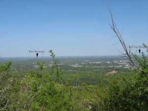
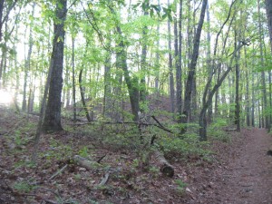
After hiking around Allatoona, I drove south to Kennesaw and did the hike to the top of Kennesaw Mountain, which took about an hour. Kennesaw Mountain rises about 800 feet above the surrounding countryside. The view from the top is impressive. You can see from Atlanta in the south to Allatoona in the North, a span of something like 50 miles. Except for a few isloated Mountains, the country is of a gently rolling nature, much like eastern Massachusetts. It is no wonder that the few mountains played such a key role in the Civil War Campaign for Atlanta. The holders of those hills, had huge advantages of observation and communication. Here is a picture I took from the top of Kennesaw, looking north.

Looking north from Kennesaw

Looking north from Kennesaw

The other thing I noticed while hiking Kennesaw is that the main Confederate trench lines were located near the top. Certainly part of the reason for this is that the energy of any attackers would be reduced by the climb up to reach them. Certainly, making a successful attack against this position would have been very difficult. However another the thing to keep in mind is that the mountain is only about a mile long, part of a six mile long defensive line. Eventually Sherman was able to flank this line, like the ones before it.

Battlefield at Allatoona Pass, Georga

The day after Vintage Computer Festival Southeast, I spent some time north of Atlanta visiting some Battlefields. First I visited the Battlefield at Allatoona Pass. For numbers engaged, this is said to be the bloodiest battle of the Civil War. You can read a bit about the battle here.

The battlefield is now a very peaceful State Park. It is located about 20 miles north of Kennesaw about a mile or so off of I-75. Here is an image of the pass looking from North to South.

Allatoona Pass

Allatoona Pass

The next picture shows the initial position of the 12th Illinois, looking from the Confederate approaches. This position is a natural bastion and seems like it would be very difficult to attack. Indeed the attacks upon this position failed early on and were not pressed. The 12th Illinois later vacated this position and went to a more threatened position.

Position of 19th Indiana (at top of bluff)

Position of 19th Indiana (at top of bluff)

The most interesting thing I found about this battlefield is the state of preservation of the earthworks, most of which are extraordinary. I was a bit confused as to why the remaining defenses are mostly oriented to face an attack from the north. This is despite that fact that the Confederates surrounded this position and attacked from all sides. History say that there were south facing defenses, but none remain.

Later in day, I asked the ranger at Kennesaw Headquarters about this, and he thought for a minute and said that the reason is that these defenses were taken over from the Confederates, who had erected defenses here to stop Sherman from reaching Atlanta. However this doesn’t completely explain why the records indicate that there were south facing fortifications, that are now, nowhere to be seen. This is in direct contrast to the extraordinary condition of the north facing defenses.

I have been thinking about it off and on for a few weeks and have a possible explanation. The north facing defenses were probably constructed by the Confederates (probably slaves) and reused by the US troops. However, the US troops had to construct their own south facing defenses. Due to lack of time, energy and the likelihood that this position was only likely to be attacked by raiders, they constructed log breastworks from felled trees, instead of digging proper entrenchments. Those south facing wood breastworks constructed by US troops either rotted away or were burned as firewood by neighboring families and now leave little trace. Now this is pure conjecture, but it is the only way that I can rectify the historical record of an all around defense with remaining evidence.

There is one other thing that bothered me, when walking the ground. The trenches of the 4th Minnesota end at the sunken wagon road that passes across the hill. Between the 4th Minnesota and the 12th Illinois, was a gully that some Confederates used for cover when their attack failed. These Confederates were trapped in this gully and some 80 of them ended up surrendering at the close of the battle. However the trenches of the 4th Minnesota do not face this gully and the 12th Illinois left their positions to reinforce other positions after the Confederate attacks on them failed. So how did the 4th Minnesota maintain enough firepower to keep these Confederates pinned down in a gully that their trenches did not face. My conclusion, is that the left of the 4th Minnesota had to be refused and extended along the sunken wagon road, which directly overlooked the gully containing the trapped Confederates. Today, this sunken road is the perfect depth to act as an entrenchment. Another piece of pure conjecture, but it is the only possible explanation that makes sense to me.

Stay tuned, I’ll talk a bit about Kennesaw Mountain in a future post.

Civil War Olive Green

Based on some new photoshop experiments, I’m starting to think I was off on my Civil War Carriage Olive Green assessment. Check out my updated page.

http://www.willegal.net/iron_brigade/olivepaint.htm

Also note that I discovered a new City Point Photo on the National Archives pages.

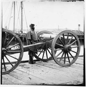
Napoleon on the ordnance wharf at City Point

Napoleon on the ordnance wharf at City Point

This is listed as at unknown location, but it clearly is taken on the ordnance wharf at City Point. You can even see lettering on the carriage that indicates that it came from Washington Arsenel to City Point. The Library of Congress call number is: LC-B811-2582

A while back I found a photo at the National Archives that was identified as taken at City Point, but was actually taken at Belle Plain. I send an email to the administrators and they said they didn’t have time to verify my assertion and make a change. This item can be found on the National Archives website by searching for ARC identifier 529319.